Tropical Depression Bertha weakens over Houston as coastal storm warnings are dropped
As of the National Hurricane Center's 7 p.m. CDT advisory Thursday, July 23, Bertha had weakened to a tropical depression over Houston — 35 mph winds, expected to dissipate — and all coastal watches and warnings were dropped. Here's what it means, plus an evergreen Gulf Coast storm-prep checklist.

By David Weaver
Publisher & Editor
Published July 23, 2026, 10:01 PM ET
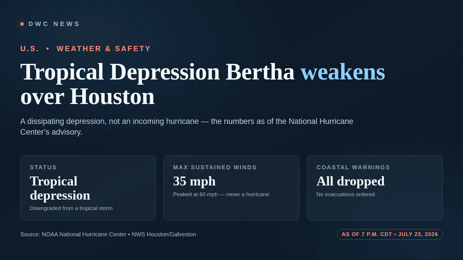
The most important thing to say about Bertha is the thing a lot of headlines get backwards: this is a storm winding down, not building up. As of the National Hurricane Center’s 7 p.m. CDT (8 p.m. ET) intermediate advisory on Thursday, July 23, 2026, Bertha had been downgraded from a tropical storm to a tropical depression, sitting essentially on top of Houston with maximum sustained winds of about 35 mph, drifting west near 13 mph. The NHC said additional weakening was expected and that Bertha was likely to dissipate Thursday night or Friday. It was never a hurricane, and by the time it reached Houston it was a weak, disorganized system on its way out.
So the right posture here is prepare, don’t panic — and, honestly, the most useful thing this page can do is help you get ready for the next storm, because there will be one. That’s what the checklist and the explainer below are for.
This is not a live tracker. Every position, wind speed, rainfall figure, and warning below is as of the 7 p.m. CDT / 8 p.m. ET advisory on July 23, 2026 and will change. For Bertha’s current location and any active watches or warnings, go straight to the National Hurricane Center and your local National Weather Service office.
What the 7 p.m. advisory actually said
Per the NHC’s 7 p.m. CDT intermediate advisory, as reported from the advisory text:
- Status: downgraded to a tropical depression (winds of 38 mph or less).
- Location: roughly 10 miles north-northeast of Houston, near 29.9°N, 95.3°W.
- Winds: maximum sustained near 35 mph, with higher gusts.
- Movement: toward the west near 13 mph.
- Pressure: minimum central pressure about 1007 mb.
- Outlook: additional weakening expected; likely to dissipate Thursday night or Friday, July 24.
Crucially, as of that advisory the NHC and NWS had discontinued all coastal tropical storm watches and warnings for the Texas and Louisiana coast — the earlier Tropical Storm Warning that had run to Sargent, Texas was dropped. No evacuations were ordered for the Houston/Galveston area. Local officials, including in Harris and Galveston counties, framed Bertha less as a crisis and more as a preparedness reminder — a dry run for the heart of hurricane season.
The residual hazards, all attributed to the NHC and NWS, were modest and mostly passing: 1 to 3 inches of rain (locally up to 4) across the middle and south Texas coast through Thursday night, with isolated flash flooding possible, mainly in urban areas — the NWS Houston/Galveston office called the local flash-flood threat “marginal.” An earlier storm surge of 1 to 3 feet was already subsiding. The most durable danger along the coast was life-threatening surf and rip currents on Louisiana and Texas beaches, which can persist even as a storm falls apart.
A note on sourcing: the NHC’s primary advisory text pages were not directly retrievable at publication, so the figures above come from reporting that quotes the NHC advisories; we’ve attributed them to the NHC/NWS accordingly. The firm anchor is the 7 p.m. CDT / 8 p.m. ET issuance time on July 23. Treat the current numbers as whatever the NHC is showing right now.
The part that outlasts Bertha: how to read a storm — and how to be ready
Bertha will be gone by the weekend. The two things worth keeping are how to read what the NHC actually tells you, and a checklist you can run for any storm.
Watch vs. warning. These are not synonyms, and the difference is the whole game. A watch means storm conditions are possible — generally within about 48 hours — so it’s time to review your plan. A warning means those conditions are expected, generally within about 36 hours — time to act. When the NWS issues a warning for your area, that is the moment to finish preparing or to follow any evacuation order.
The cone. The famous “cone of uncertainty” shows the probable track of the storm’s center — not how big the storm is and not where the impacts will be felt. Rain, wind, surge, and rip currents routinely reach well outside the cone. Never assume you’re safe just because the line isn’t drawn over your house.
The categories. The NHC ranks systems by maximum sustained wind: a tropical depression is 38 mph or less; a tropical storm is 39 to 73 mph (and gets a name); a hurricane is 74 mph or more, then graded Category 1 to 5 on the Saffir-Simpson scale. Bertha peaked as a 60 mph tropical storm and, by Houston, had fallen back to a depression. That’s why calling it a “hurricane” is simply wrong.
And then the practical part — the go-bag, the water, the evacuation zone, the generator rules. The checklist below is built to work for any Gulf Coast storm, in any season. It routes only to official sources: the NHC, your local NWS office, Ready.gov, and your county emergency-management office. Work through it before a storm is ever named.
Gulf Coast Storm Prep Checklist
Gulf Coast hurricane and tropical storm prep checklist
A phase-by-phase preparedness checklist for anyone on the Texas and Louisiana Gulf Coast: what to do before a storm forms (build a plan, a go-bag, and a 72-hour kit; know your evacuation zone), during it (shelter or evacuate, never drive through flooded roads, run generators outdoors only), and after (return safely, avoid hazards, report outages). Works for any tropical storm or hurricane — general preparedness information routed only to official sources, not a live forecast or an evacuation order.
This is general preparedness information — not a forecast, not an evacuation order, and not emergency instructions for any specific storm. Follow the National Hurricane Center (nhc.noaa.gov), your local NWS office, and your local emergency-management officials for official guidance and any orders. In a life-threatening emergency, call 911.
0 of 19 done
How this is calculated
The checklist follows the standard three-phase structure that federal and local emergency managers use — before, during, and after a storm — and every action mirrors the published guidance of Ready.gov (FEMA/DHS), the National Weather Service, and county emergency-management offices. Each step links only to an official government resource. It states no forecast, no storm position, no evacuation order, and no rule as applying to any specific address, because those come from the National Hurricane Center, your local NWS office, and your local officials in real time — not from this page. Checklist progress is stored only in your browser tab.
Data as of July 22, 2026 · verified July 22, 2026 · v1
Assumptions, limitations & sources
Assumptions
- · The reader lives or is staying somewhere on or near the Texas/Louisiana Gulf Coast that can be affected by tropical storms and hurricanes.
- · Whether to evacuate, shelter, or return home is decided by local officials for a specific area and time — this tool prepares the reader to act on those orders, it does not issue them.
Limitations
- · This is general preparedness information, not a forecast, not an evacuation order, and not emergency instructions for any specific storm or address.
- · Only the National Hurricane Center (nhc.noaa.gov) has the current position and intensity of a storm, and only your local NWS office and county emergency-management office can issue watches, warnings, and evacuation orders for your area.
- · Official checklists, phone lines, evacuation zones, and shelter locations change — confirm current details on the official page before relying on them.
- · In a life-threatening emergency, call 911.
- · Checklist progress is stored only in this browser tab.
Sources
- National Hurricane Center (official forecasts, advisories, watches and warnings) — NOAA National Hurricane Center, checked July 22, 2026
- National Weather Service — Houston/Galveston (HGX) forecast office — NOAA National Weather Service, checked July 22, 2026
- Ready.gov — Hurricanes — U.S. Department of Homeland Security (Ready.gov / FEMA), checked July 22, 2026
- Ready.gov — Build A Kit — U.S. Department of Homeland Security (Ready.gov / FEMA), checked July 22, 2026
- Ready.gov — Power Outages (includes generator safety) — U.S. Department of Homeland Security (Ready.gov / FEMA), checked July 22, 2026
- National Weather Service — Turn Around, Don't Drown — NOAA National Weather Service, checked July 22, 2026
- National Weather Service — Rip Current Safety — NOAA National Weather Service, checked July 22, 2026
- ReadyHarris — Harris County Office of Homeland Security & Emergency Management — Harris County Office of Homeland Security & Emergency Management, checked July 22, 2026
- Galveston County Office of Emergency Management — Galveston County Office of Emergency Management, checked July 22, 2026
This is what modern SEO looks like: not just an article, but a useful resource people can return to, cite, and share. See how this newsroom is growing · See DavidWeaver's SEO packages
How Bertha unfolded
A short, attributed timeline of the 2026 season’s first US-landfalling storm:
- July 20 (evening): Bertha forms as a tropical storm in the northeastern Gulf, per the NHC.
- July 21: peaks at about 60 mph — a moderate tropical storm, and its strongest point. It never reached hurricane strength.
- July 22 (around midday): makes its first US landfall of the season near St. Bernard Parish, Louisiana, per reporting quoting the NHC.
- July 23 (around 1 p.m. CT): moves inland into Texas and passes north of Galveston, weakening as it goes.
- July 23 (7 p.m. CDT): downgraded to a tropical depression over Houston; all coastal watches and warnings discontinued.
The bigger danger has shifted east
The most serious threat tied to Bertha may no longer be on the Gulf Coast at all. Bertha’s leftover moisture, colliding with a stalled front, is helping drive a multiday flash-flood threat across the Carolinas and Mid-Atlantic, with parts of eastern North Carolina forecast to see 8 inches or more of rain and a Level 3 (of 4) flash-flood risk, as CNN reported. If you’re in that corridor, the same “Turn Around, Don’t Drown” rule in the checklist applies to you now — and your local NWS office, not this page, has the live warnings.
Questions people are asking
Where is Bertha now, and is it hitting Houston? As of the NHC’s 7 p.m. CDT advisory on July 23, the center was about 10 miles north-northeast of Houston and drifting west as a weakening depression — so it was over the Houston area, but as a fading system, not an incoming storm. It was forecast to dissipate. For the current position, check the NHC.
Is Bertha a hurricane? No. It never reached hurricane strength (74 mph). It peaked as a 60 mph tropical storm on July 21 and, as of 7 p.m. CDT July 23, was a tropical depression with 35 mph winds. Any change would be posted by the NHC.
Is it still a tropical storm? Not as of that advisory — it was downgraded to a tropical depression at 7 p.m. CDT on July 23. A depression has winds of 38 mph or less and no longer carries a tropical-storm designation. Latest status is at the NHC.
When will it hit, and how long will it last? The heaviest of Bertha’s impacts were already passing at the time of the 7 p.m. CDT advisory, and the NHC expected the system to dissipate Thursday night or Friday, July 24. There was no separate, building landfall still to come for the Houston area. Confirm timing with your local NWS office.
How much rain and flooding should I expect? Per the NHC and NWS as of that advisory: 1 to 3 inches across the middle and south Texas coast (locally up to 4), with isolated, mainly urban flash flooding possible; the NWS Houston/Galveston office called the local threat “marginal.” Rainfall forecasts change — get the current numbers from NWS Houston/Galveston.
Do I need to evacuate? As of the 7 p.m. CDT advisory, no evacuations had been ordered for the Houston/Galveston area, and officials treated Bertha as a preparedness reminder. Evacuation orders come from local officials, not from this page — if one is issued for your area, follow it. Your county emergency-management office and the NWS are the authorities.
Will there be power outages? Scattered outages are always possible in wind and heavy rain, but no widespread outage event had been reported for the Houston area as of that advisory. CenterPoint Energy said it had pre-staged more than 1,050 crews and pointed customers to its outage-alert service. Report any outage to your electric utility, and see the generator-safety steps in the checklist above.
How do I track Bertha live? Go to the National Hurricane Center for the current position, forecast cone, and advisories, and to your local NWS office for watches, warnings, and local rainfall. This article is a snapshot as of 7 p.m. CDT July 23; those official pages update continuously.
The bottom line
As of the NHC’s 7 p.m. CDT advisory on July 23, 2026, Bertha was a weakening tropical depression over Houston, expected to dissipate within a day, with all coastal watches and warnings dropped and no evacuations ordered. It was never a hurricane. The rain and surge were mostly passing; the lingering coastal risk was dangerous surf and rip currents, and the bigger ongoing flood danger had moved east into the Carolinas. Everything time-sensitive here is a snapshot — for anything live, the National Hurricane Center and your local NWS office are the only authorities. Use the quiet to get ready for the next one.
Sources
- National Hurricane Center — official forecasts, advisories, watches and warnings — NOAA National Hurricane Center · primary source
- National Weather Service — Houston/Galveston (HGX) forecast office — NOAA National Weather Service
- Tropical Storm Bertha makes landfall along the Gulf Coast — FOX Weather
- Bertha nears Texas coast; officials urge residents to use the storm as a preparedness reminder — KPRC 2 Click2Houston
- Bertha's remnants fuel a flood threat in the East — CNN
- Ready.gov — Hurricanes preparedness — U.S. Department of Homeland Security (Ready.gov)